Check nearby libraries
Buy this book

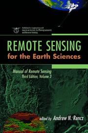
Remote Sensing for the Earth Sciences is a comprehensive, up-to-date resource for geologists, geophysicists, and all earth scientists. Produced in cooperation with the American Society for Photogrammetry and Remote Sensing, it is the third volume of the Manual of Remote Sensing. Third Edition, the widely accepted basic reference work in the field. It brings together contributions from an international team of scientists active in remote sensing and earth sciences research.
Complete with color figures, helpful illustrations, and thorough references - including Internet sources - this volume is a major resource for researchers and practitioners working in the earth and environmental sciences.
Check nearby libraries
Buy this book

Previews available in: English
Subjects
Remote sensing, Earth sciences, Imaging systems| Edition | Availability |
|---|---|
|
1
Manual of Remote Sensing, Remote Sensing for the Earth Sciences (Manual of Remote Sensing - Third Edition)
March 8, 1999, Wiley
in English
0471294055 9780471294054
|
zzzz
|
| 2 |
aaaa
|
| 3 |
eeee
|
Book Details
Edition Notes
Includes bibliographical references (p. 694-697) and index.
Classifications
The Physical Object
Edition Identifiers
Work Identifiers
Community Reviews (0)
History
- Created April 1, 2008
- 6 revisions
Wikipedia citation
×CloseCopy and paste this code into your Wikipedia page. Need help?
| July 31, 2019 | Edited by MARC Bot | associate edition with work OL18242083W |
| April 14, 2010 | Edited by Open Library Bot | Linked existing covers to the edition. |
| April 1, 2010 | Edited by bgimpertBot | Added goodreads ID. |
| April 22, 2009 | Edited by ImportBot | Found a matching Library of Congress MARC record |
| April 1, 2008 | Created by an anonymous user | Imported from Scriblio MARC record |


