It looks like you're offline.
Open Library logo
additional options menu
Last edited anonymously
April 29, 2008 | History

Roger J. P. Kain

We need a photo of Roger J. P. Kain

8 works Add another?

Sorting by Sorted by: Most Editions | First Published | Most Recent | Top Rated | Reading Log | Random

Showing all works by author. Would you like to see only ebooks?

  • Cover of: Atlas and Index of the Tithe Files of Mid-Nineteenth-Century England and Wales

    My Reading Lists:

    Create a new list

    Check-In

    ×Close
    Add an optional check-in date. Check-in dates are used to track yearly reading goals.
    Today
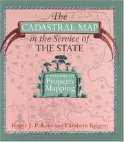
  • Cover of: The Cadastral Map in the Service of the State: A History of Property Mapping

    My Reading Lists:

    Create a new list

    Check-In

    ×Close
    Add an optional check-in date. Check-in dates are used to track yearly reading goals.
    Today
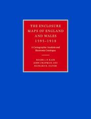
  • Cover of: The Enclosure Maps of England and Wales 1595-1918: A Cartographic Analysis and Electronic Catalogue

    My Reading Lists:

    Create a new list

    Check-In

    ×Close
    Add an optional check-in date. Check-in dates are used to track yearly reading goals.
    Today
  • Cover of: Tithe Maps of England and Wales: A Cartographic Analysis and County-by-County Catalogue

    My Reading Lists:

    Create a new list

    Check-In

    ×Close
    Add an optional check-in date. Check-in dates are used to track yearly reading goals.
    Today
  • Cover of: British Town Maps: A History
    First published in 2015 1 edition — 1 previewable

    My Reading Lists:

    Create a new list

    Check-In

    ×Close
    Add an optional check-in date. Check-in dates are used to track yearly reading goals.
    Today
  • Cover of: The Tithe Surveys of England and Wales (Cambridge Studies in Historical Geography)

    My Reading Lists:

    Create a new list

    Check-In

    ×Close
    Add an optional check-in date. Check-in dates are used to track yearly reading goals.
    Today
  • Cover of: An Atlas and Index of the Tithe Files of Mid-Nineteenth-Century England and Wales

    My Reading Lists:

    Create a new list

    Check-In

    ×Close
    Add an optional check-in date. Check-in dates are used to track yearly reading goals.
    Today
  • Cover of: historic parishes of England and Wales: an electronic map of boundaries before 1850 with a gazetteer and metadata

    My Reading Lists:

    Create a new list

    Check-In

    ×Close
    Add an optional check-in date. Check-in dates are used to track yearly reading goals.
    Today

History

Download catalog record: RDF / JSON
April 29, 2008 Created by an anonymous user initial import